I finally organized all of the photos on The Robot. The ones that need to be done on my smartphone and laptop have yet to be moved. Next task with these is naming them so that I can use the operating system's native search function to find them later and faster.
I'm curious to see how many of them are geotagged? That's the primary reason for doing this. And some of them that aren't, I can embed a tag after the fact. Those that are tagged can be imported into Google Earth. When The Robot had a different configuration, I did this. But their Google Earth properties are based on the previous file structure and those embedded placemarks might not read anymore.
Visual maintenance records for the Whipple Section - Buckeye/ North Country Trail are among them. I'm hoping to take plenty of geotagged photos when I hike through the rest of the Scioto Trail, Sinking Spring and West Union Sections - Buckeye/ North Country/ American Discovery Trail.
A member of the Buckeye Trail Association's Facebook group recently just got his first smartphone. The question is could one last 10 years. And I'm skeptical that one could go that long. I have one now that was on the market maybe 3 or 4 years ago. And right now, I'm having problems with it's 25GB of internal memory. The internal memory can't be upgraded and many apps force themselves to be installed there. And now, my operating system won't read the two drives when it's tethered.
2017/01/30
ADT GPS Tracks Almost Lost
I just had to do a partial reinstall of Windows 10 today. And since I haven't made a back-up of my My Places in Google Earth recently, I almost lost my main line track of the American Discovery Trail. But I just remembered that when you save your My Places, it just goes to a file on a hidden directory. I found it and made a copy, but it wasn't necessary because the new installation of Google Earth just picked it up. All of my ADT tracks are in tact as far as I can tell. But I won't be able to make an external backup for a couple days or so.
2017/01/28
The North Face Style #NF0A2TC6
I purchased a new jacket. It's from The North Face and is Style #NF0A2TC6. I had it out for about 30 total minutes with every layer on at 32°F and didn't need gloves when I was outside.
2017/01/27
ADT Tracks Completed
The American Discovery Trail (ADT) in the State of Nevada

This was the missing piece. After I got done with California, I forgot that I skipped a head and when I reviewed Nevada's track, I found that I wasn't done after all. That's it, I have tracks for the ADT from coast to coast now.
A couple who were already ADT thru hikers did another one. And they finished a track as well. My guess is that they might have gone on the latest thru hike to field test it? My tracks are a bit rough in some places. And I've never been on a thru hike (I did this all from the desk). So, without knowing, I'd probably judge theirs to be superior. Being on the ground is a another story. I could have easily mistracked the trail in places like Utah or Nevada. When they're available, I'd go with their tracks, too.
From what I understand, the American Discovery Trail Society will need to determine how to deploy theirs. My work is ineligible for that mostly because it could violate the terms of use of the free products that I used to generate it.
Right now, my tracks are great for plotting the locations of commercial campgrounds, hotels, motels, bed & breakfasts, hostels, libraries, post offices and grocers. I only work with stated amenities and discount incidental trail angels. Couchsurfing and AirBnB was covered in a previous log entry and can require some lengthy preparation.
All this information is necessary to write what I like to refer to as a "mock hiker." it's a document that details the day to day mileages of a typical thru, and 10 mile per day hiker. It's "mock" because the hiker is imaginary. And I'm not intending to get to it soon. The tracking project took 19 days. If I remember being new to mapping correctly, this could taken the average person 6 months to prepare months to prepare. I gotta say... that's too long.
Something that I've done with the Buckeye Trail (which also has mostly fixed amenities) is that I've analyzed it. I've heard it said that hikers cover the trail in all different ways. But when you have a typical, or average time frame, that makes things easier because it's now a matter of how to do it, what mileages and where?
Now this might reveal that certain places have amenity gaps. This is where the hiker on the route is at the end of their stamina, but there's no place to sleep. But it's not exactly the "end of the world." There is a method that I like to apply last and that is transit. Sometimes you can find it in the smallest counties. I apply it last because it's antithetical to the notions of some hikers. Yet they aren't always aware that certain rural transit agencies use Dodge Caravans.
There's also something else... the American Discovery Trail has up and coming state committees for which they need volunteers for. If your interested, you should contact a state coordinator and let them know. But there is one thing that they might be able to do. North Country Trail and other agency is already doing it. It's about re-occurring trail angels. Some of them might be willing to go on a roster, but where they're names and contact information won't go on a web page? It's only available to those who request it.
2017/01/24
Log 2017012402
Log entries from here on out will no longer a title with a government date format unless I'm at a loss as to what to call it. This might still happen if I'm in a rush, or publish a log with different topics.
Smartphone At Your Desk
When mapping, one thing that I use sometimes is my smartphone. By a controversial definition that is still in play from the 1970's, a smartphone is a computer. Most of the time, I like using it as a calculator because it doesn't detract from what's already going on with The Robot (my desktop computer). What I use is a round weighted base that more so marketed for automobile dashboards. It has a plastic disc mounted in the top center. This is where I use a smartphone windshield mount with a long goose neck and suction cup at the bottom. From there, the smartphone's constrictor squeeze the device and hold it in to place.
From time to time, the plastic cup looses suction where the goose neck and smartphone fall over. If I had to do it again, I would use some plastic putty from JB Weld and permanently attach it. A thin layer on the suction cup ought to do.
The goose neck should last indefinitely, but the smartphone mount's side constrictors have foam like padding. After a while from being depressed a lot, the padding will become ineffective. There are two things that I can do about that. One is that I might be able to use thin strips of duct tape to adhere to pieces of rubber foam insulation used on pipes. The other is to buy another backplate and goose neck, but only use the new backplate on the existing stem. In case you don't know, the backplate has a slot that allows you to separate it from the goose neck.
Log 2017012401
I finished the tracks for the American Discovery Trail in Nevada today. Then I started California's, which is probably more difficult to do than Colorado. Go figure, they saved the hard stuff for last. My brain is starting to turn to mush.
2017/01/23
Log 2017012301
I have the GPS tracks now for the American Discovery Trail in Utah. The tracks that I downloaded for the Great Western Trail were unusable. So, I had to trace it based on how it's shown in my USGS Topo overlay in Google Earth.
The ADT in Nevada and California are the only remaining states that haven't tracked yet.
- The "My Places" in my Google Earth application is about 185 megabytes. The last time that I checked, that's a lot of data for mapping.
The ADT in Nevada and California are the only remaining states that haven't tracked yet.
- The "My Places" in my Google Earth application is about 185 megabytes. The last time that I checked, that's a lot of data for mapping.
2017/01/20
Log 2017012001
To recap, I'm finished GPS tracking the American Discovery Trail from the Atlantic Ocean to the Colorado/ Utah States Line. Western Colorado took a little more work, but not it wasn't a nightmare. I still have a little bit of clean-up to do on the Colorado and Continental Divide National Scenic Trail's tracks.
2017/01/19
Log 2017011901
I got Segment 5 on the American Discovery Trail - Colorado tracked out. It's a bit rough because it uses tracks from both the Colorado and Continental Divide National Scenic Trails. There's a couple parts where my ADT track diverges from it, so I'll have to go back over it again. This part of Colorado on the ADT goes up to 6 segments, but that final one is really big.
I had to get memberships in a bunch of websites today, pulling tracks from other sources. Usually, I map a segment in one, two or rarely 3 pieces. Segment 5 took 10. I'm not sure how much better Utah and California might be?
I've been tracking the ADT quickly. I'm probably making it look easy. Well, I've been doing this on distance trails for the last 4 years now. And I have a method that's down pat. It took years to master this kind of mapping.
I don't have my pen tablet working and wish I did. It's a 5in x 8in touchpad with some padding. I have a pen that goes with it that has a special tip for making contact with it. Normally, these are used by applied artist and graphic designers for drawling. It has a button that I touch with my index finger and I usually configure it to simulate a repeated left click. That way as I trace, or draw a custom track in Google Earth, it constantly lays down anchors. It hasn't been needed too much so far, but I'm thinking that it's going to come in handy on ADT's Western Region.
2017/01/17
Log 2017011701
I found the tracks for the American Discovery Trail - Indiana on the South Mid-West Arm in the Clark State Forest. They're on AllTrails (fee service) at this link. That's it. I have a GPS track for every bit of the Eastern and Central Regions. I only hope that AllTrails works this well when I go to map the ADT's west.
Brief Overview: Buckeye, North Country and American Discovery Concurrency in Ohio
Everything here is written from the clockwise/ westbound direction of travel.
The Buckeye Trail is a 1,440 mile circle within the four corners of Ohio. From Pennsylvania, the North Country Trail is independent of the Buckeye for 84 miles until it reaches the 3-way intersection in the historic Village of Zoar in Tuscarawas County.
American Discovery Trail comes out of Parkersburg, West Virginia and enters Belpre of Washington County. It's independent for about 32 miles until just east of Chesterhill in Marion Township of Morgan County.
Then the Buckeye, North Country and American Discovery Trails run concurrent for about 7 1/2 of Buckeye's southern sections until the City of Milford in Clermont County (near Cincinnati). Buckeye wasn't always a circle, so Eden Park is the site of Buckeye's present day honorary Southern Terminus. At Milford, ADT towards California turns south while the NCT towards North Dakota splits north and continues along Buckeye's main circle.
About 5 of Buckeye's sections further north is where the Buckeye and North Country split on the Miami & Erie Canal Towpath Trail in Liberty Township of Henry County towards Battle Creek, Mi and again, North Dakota.
Log 2017011701

I just finished tracking Iowa and Nebraska on the American Discovery trail. As you see, I use red. It's kind of an Ohio thing. Buckeye and North Country's track colors are that of their blaze paint. ADT doesn't blaze, so I just assigned them as red so that white can be reserved as the inverse color for by-passes and spurs.
For the ADT, I only have Ohio's done. And for the most part, BT/ NCT doesn't use them. When an ADT adventurist has a question about the concurrency, they should contact Buckeye. That's because Buckeye mostly administers the route there. Trail maintenance is Buckeye only. Buckeye has more many more volunteers. There other examples as well. But those bypasses are ADT only. I don't suppose that BT people are going to know much about them. And as for the ADT's Facebooks, another and myself are the only ones out here. If a question occurs regarding those by-passes, we might be the only readily accessible people who'd know who'd know anything about them. On Buckeye Trail's Facebook group, a question concerning these could arise. In which case, they might need a translator (me).
So far, I've got everything between Delaware and the Denver area tracked. I have no idea how big this loop is, yet? I'm not planning on traveling it. The next step is track the Western Region and then I'll be complete. The second phase is to continue populating my camping/ lodging data. Once that's done, I can write a mock hiker document, determine what it takes to get across the trail in 6 months and if there's any need for amenity improvements? If there are, could public transit solve some of those issues?
The only place that I don't have any data for on this map is Clark State Forest on ADT Indiana's South Mid-West Route.
2017/01/16
Log 2017011601
Today's tip regards the amateur GPS mapping of the American Discovery Trail (ADT).
When creating a GPS line for the ADT in Google My Maps, it easier to do if you import a state's GPX data. Then creating walking directions, if it's urban/ suburban, only route that track for about 40 ADT miles (require more corrections in less distance). The rural's could go as high 90. In either case, the walking, or cycling directions in My Maps start off as Point A to Point B. But you can add directions up to "J" (and you probably should). After that, you can reroute the track about 15 additional times.
Log 2017011601
I have the GPS tracks for the American Discovery Trail (ADT) - Illinois on the North Mid-West Route (NMR).
For a running list, I currently have ADT tracks for:
Delaware
Maryland (incld. DC)
West Virginia
Ohio
Ohio NMR & SMR
Indiana NMR & SMR
Illinois NMR & SMR
Missouri SMR
Kansas SMR
Colorado NMR & SMR (but not west of Denver yet)
- The largest city on the ADT is San Francisco, California at (population).
2017/01/15
Log 2017011502
I got the tracks done for the American Discovery Trail - Colorado on the North and South Mid-West Route (NMR & SMR) only. As you may have read in my previous logs, I have a complete set of GPS tracks from Delaware to Colorado via the SMR. My data is partially complete on Indiana's NMR. I might do it tonight. If I complete it, of course all of you out there in Internetland will know about it.
Log 2017011501
This my GPS track for the American Discovery Trail (ADT) - Missouri's main lilne. There's placemarks for amenities in Illinois. They're for campsites, campgrounds, motels, hotels, bed & breakfasts and hostels. I haven't got any further west with those yet. Today, I was busy with the tracks (the line you see here).

This is the track for the mine line ADT - Kansas. It took about 4 hours to make on Google My Maps. Kansas has 8 segments and I made walking directions for each one. I can specify about 10 different locations each and then alter that track about up to 15 times or so. So if your doing this at home, you might want to break up segments if they're longer than 90 miles.

Log 2017011501
This is from the US Forest Service - Wayne National Forest's Facebook page.
U.S. FOREST SERVICE PROJECT WILL CLOSE AND RESTORE HAUGHT RUN CAMPGROUND
The Haught Run Campground Decommissioning Project may be implemented immediately
NELSONVILLE, Ohio (January 13, 2017) – Athens District Ranger Jason A. Reed of the Wayne National Forest signed the Final Decision Notice for the Haught Run Campground Decommissioning Project on Tuesday, January 3rd. He selected Alternative 3 for implementation. Alternative 3 involves permanently closing and restoring the campground and the short access road entirely within it, and administratively removing an oil and gas well access road from the Forest Service System of Roads. There will be no work on Haught Run Road itself or on the Covered Bridge Trail.
The campground is located along the Little Muskingum River in Ludlow and Independence Townships, Washington County, Ohio, and is part of the Marietta Unit of the Athens Ranger District.
The U.S. Forest Service has determined that permanently closing the campground is needed in order to protect human health and safety. Haught Run Campground has been and continues to be impacted by extensive bank erosion along a curve in the Little Muskingum River. Currently three out of four campsites are unsafe to occupy. Because of how the campground is situated between Haught Run, the Little Muskingum River, and a ridge, there is no room to move the campsites to safer spots. An emergency closure order was issued in 2014 and the campground remains closed. Despite the closure order, there is evidence that people are still occupying the campground and have been using the sites that are most at risk for continuous streambank erosion.
“It is of the utmost importance that we provide destinations that are safe to all visitors and those who live in and around the Wayne National Forest,” stated Reed. “This river and the surrounding lands offer endless opportunities to experience the forests and wildlife of southeast Ohio. We will continue to talk with the community about recreational opportunities in this area.”
Several other camping opportunities exist on the Marietta Unit that offer a similar experience to Haught Run, including Hune Bridge, Ring Mill, Lane Farm, and Lamping Homestead Campgrounds.
Decommissioning activities include removing pavement, fire rings, picnic tables, and structures. A mix of native and non-native, non-invasive plants and trees will be seeded in. Rock would be used to block off the area until vegetation is re-established.
The project may be implemented immediately.
2017/01/14
Log 2017011401
- I have the GPS tracks, or a line for the American Discovery Trail in Missouri on the South Mid-West Route. So far, it's the main routes only.
Log 2017011401
I now have enough navigational aids to route across that entire trail. The campgrounds and lodging are plotted in placemarks in Google Earth for Illinois on the South Mid-West Route. And I could have swore that I purchased Colorado's turn by turn guide and data before, but I can't find it. I know that I once had it because the western part of the state
I can't get the standalone application "shp2kml" to work. When I rolled my computer's clock back to 1/1/2011, it shut down my Internet access. And it kept giving me a bogus error every time I tried to convert to KML. I've been trying all night to covert the shapefiles of 9 more national forests along the American Discovery Trail. So, I purchased a license for "Shape2Earth" for $39.99. It could take them a couple hours to process my purchase, so I'll catch up with my email for a serial number this afternoon sometime.
When I get all those forests converted, I'll upload the entire pack so that prospective adventurists online can download and open them in Google Earth at home. I'll also link them in a post on the American Discovery Trail's Facebook Group. If the forest allows dispersed camping, it must take place on lands that the federal government actually owns.
2017/01/13
Log 2017011301
My map repository is organized. But I'm not sure how my discontinued Picasa application is doing. Picasa reads the geotags from my photos and then can transfer them over to Google Earth. That's how I've made my maintenance photos for the Whipple Section - Buckeye Trail (North Country concurrent). I'm also starting to photographically catalog the trail as well.
The map repository on my hard drive needed to be reorganized in order to save and open North County and American Discovery files better. It's organized by trail agency, state and providence. And the folders are numbered and named to force them order based on one of their trail's terminators.
The map repository on my hard drive needed to be reorganized in order to save and open North County and American Discovery files better. It's organized by trail agency, state and providence. And the folders are numbered and named to force them order based on one of their trail's terminators.
2017/01/12
Trail Patches for Warm Weather Hiking and other T-Shirts
I know a way to get trail patches on warm weather clothing. Sewing patches on would make then heavier and not breathe as well. But many of us now and days have "all-in-one" printers. So, why not put that scanner bed to work? Honestly, the trail agencies should sell them like this. Maybe they should increase the price of the sewn patch and offer 2 iron-ons that come with it? Using a scanner isn't everybody's thing. If your a volunteer and a member of something like a chapter, you might be able to get your agency's headquarters to approve this as a fundraiser for it? You should also make sure that you have an exclusive deal, too. It's fair to the other chapters because it's likely that this will only last for a certain period of time. There's also the fact that you asked first.
Once scanned, it should probably be saved as an image file, such as ".jpg" or ".png" format. T-shirt press paper can be purchased from your local big box office supply store. While not entirely necessary, one might want to position as many patches on computer software as possible so that they don't have to waste paper on just one. This is a thermal transfer paper that uses an iron, steam, a pillow sheet and the image on the t-shirt paper itself. It only works with an inkjet printer (lasers won't work).
Once scanned, it should probably be saved as an image file, such as ".jpg" or ".png" format. T-shirt press paper can be purchased from your local big box office supply store. While not entirely necessary, one might want to position as many patches on computer software as possible so that they don't have to waste paper on just one. This is a thermal transfer paper that uses an iron, steam, a pillow sheet and the image on the t-shirt paper itself. It only works with an inkjet printer (lasers won't work).
Log 2017011201
At about 10:30p yesterday, this log exceeded 10,000 pageviews. There are currently 677 published logs.
2017/01/11
Log 2017011102
 |
| Pemberville Section - Buckeye Trail, taken in the first quarter of 2010. |
These roads do get snow covered and they're not always plowed as much as a highway. During those times, foot gear like "YakTrax" are a must to wear. Snowshoes are almost never needed. As of the date of this log, the Pemberville and it's neighboring section, the Norwalk are almost entirely on-road. Its a part of the trail that many day hikers put off and dread covering. But if they own more conventional gear and don't wish to take on the expense of snowshoes or skis, then this area in the winter is the place to be. And that's because it's one of the only places in that season that they can hike. With YakTrax, Pemberville and Norwalk Sections are cold, but they're almost always open for business.
Log 2017011101
 |
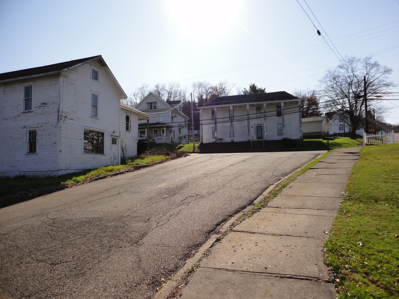
| The Village of Murray City in Hocking County, Ohio as viewed from the New Straitsville Section - Buckeye Trail (North Country and American Discovery concurrent). |
 |
| On the Buckeye Trail, I've once heard that each section was named after the largest settlement in the most populous USGS quad that the trail's routed through. This is the Bowerston Section - Buckeye Trail (North Country concurrent) in the Village of Bowerston in Harrison County, Ohio. This picture was taken heading clockwise/ westbound and just south of the Nolan Tunnel. "Clockwise" and "westbound" pertain to directions of progression on said trails. |
 |
| Senecaville Lake, part of the Muskingum Watershed Conservancy District as seen from the Belle Valley Section - Buckeye Trail (North Country concurrent) |
2017/01/10
Log 2017011001
When I checked about 40 minutes ago, these logs were 38 pageviews away from 10,000.
I've got a big meat pressure canning day planned for tomorrow. At some point, I'm going to probably pick up a vegetable canner. I'm being held accountable by my nutritional.
The day after tomorrow, I'll get the full brake job done on my 2008 Chevy HHR LS. The sooner I can do that, the sooner I can leave to hike the remaining Buckeye/ North Country/ American Discovery trail in South Central Ohio. A buddy of mine sounds like he's going to complete the circuit before I do, but I might have an edge on completing all 3 in Ohio?
Yesterday, I finally got access to my gear bin. And I used my own Full Generic Gear Inventory to create my next packing list. The trouble with the winter is that I have find all of my thermal gear. If it's not in the bin, I'll have to buy it before I launch. The winter can be lethal.
I don't have all of my pictures sorted into their proper folders, yet. I wish that I would have of had one for you today.
2017/01/09
Log 2017010901
For my previous attempt at a transcontinental hike that routed over the International Appalachian Trail - Newfoundland & Labrador, Maine, Appalachian, Long, North Country, Buckeye, Superior, Border, Kekekabic, Continental Divide and Pacific Northwest Trails. Being new and having to learn how to do GPS mapping too way too long. And when it was time to launch, it still wasn't done right.
I know what to do. Unfortunately, I'm a long ways off from doing it. It's the amatur GPS mapping class. I hope to host it near my part of the Buckeye/ North Country Trail in the Mid-Ohio Valley (Marietta (OH)/ Parkersburg (WV) area. Afterwards, I can upload a video for those elsewhere around the world. This class will likely require an overnight and take at least two days. I'll probably have to schedule a hike in between just to give them a diversion from all that I'm going to load their brains up with. But the benefit of being there might be so that the participants can ask questions.
I'm always on the lookout for a future Buckeye TrailFest location near New Matamoras, Caldwell, McConnelsville, Athens, Marietta and Belpre of Ohio, then New Martinsburg, Middleborne, Ellenboro, Elizabeth, St. Marys, and Parkersburg of West Virginia. The TrailFest has specific needs. It needs to primitive camp about 50 tents, have indoor sleeping accommodations for about 15, space for 7 RV's, 6 small classrooms, or chambers that can be converted to it, a kitchen and enough indoor seating. A chamber needs to be used for a indoor reception area. There also needs to be an indoor shocase area that's about 200sq feet in size. It will then need a room of about 300sq feet for an auction.
The last TrailFest was supposed to be SE Ohio's, but it ended up in Zoar of Tuscarawas County because finding a facility like this in SEO has been very difficult. If you know of a facility, please contact me at edmondsmd@othr.info.
2017/01/08
Log 2017010801
I found a couple of transit routes on, or near the American Discovery Trail in Eastern West Virginia. So far, the one at Fort Ashby runs on Thurdays only. If needed, it's resupply only transit. I'm still working on this part of this state. I'm only going to get and keep data for needed areas.
As for the amenity gap between Delaware and Maryland on the 10 miler rate, centered on Taber State Forest... I tried. Taber is located in one of the most remote parts of Kent County (where Dover, Delaware is). That county has paratransit, so Taber itself is only accessible to handihikers and physically handicapped cyclists. It's on a corner and Sussex County doesn't have a transit agency that will get near there and Caroline County, Maryland has fixed routes which get near the trail. But in the westbound direction, so much stamina would have been exerted getting that far down trail by this audience that there's nothing left to complete an unmarked amenity spur to the bus.
As for the amenity gap between Delaware and Maryland on the 10 miler rate, centered on Taber State Forest... I tried. Taber is located in one of the most remote parts of Kent County (where Dover, Delaware is). That county has paratransit, so Taber itself is only accessible to handihikers and physically handicapped cyclists. It's on a corner and Sussex County doesn't have a transit agency that will get near there and Caroline County, Maryland has fixed routes which get near the trail. But in the westbound direction, so much stamina would have been exerted getting that far down trail by this audience that there's nothing left to complete an unmarked amenity spur to the bus.
2017/01/07
Log 2017010703
I tried to convert my Full Generic Gear Inventory in Google Docs so that the end user selects what they want to pack. Then at the end, I wanted to make it so that when they clicked on "submit," it takes them to a list of things that they selected only. When I got to work on it, it seems that I beat myself to it and wrote the master list earlier just last year. What a surprise... that was nice.
It's not working out. For right now, I'd say that my inexperience with Google Docs is probably the cause. But it is working for just me and I had my packing list for my upcoming hike in South Central Ohio on the Buckeye/ North Country/ American Discovery Trail made and printed out.
It's not working out. For right now, I'd say that my inexperience with Google Docs is probably the cause. But it is working for just me and I had my packing list for my upcoming hike in South Central Ohio on the Buckeye/ North Country/ American Discovery Trail made and printed out.
2017/01/06
Log 2017010702

A Level 3 is also called a "snow emergency." Once the hiker is aware of it, they can't legally travel another inch when the trail is on-road. The question is can the hiker legally set up their tent and take shelter on private property with or without the owner's permission given the circumstances? You folks out there might like to debate that one. Comments can be posted at the bottom of this log.
Log 2017010101
I'm impressed with how The Robot processed it's system maintenance today. It was rather expedient. But I was surprised with how fragmented two of it's hard disk drives were. The laptop is still chugging along, but in comparison, it always has. It has a cheap AMD dual core processor. The best thing I can say about it is that it has 8GB of memory.
The laptop's purpose is to serve as a second screen at Home Port, otherwise, it just has a reduced role on the road. It's performed admirably. I don't even like AMD's. The only reason why I bought it was because it was on sale at Walmart on Black Friday 2012 and my previous unit was having problems with it's power button.
The Robot is still running without the manufacturer's drivers for it's motherboard and graphics cards. But considering the problems that I had with the previous installation of the operating system, for now, I'm willing to "let sleeping dogs lie."
My prior lower back injury took years to heal. Now, it just needs to heal. Pretty much, my doctors are just telling me to use a machine to work it out. But I might as well hike. On some lengthy routes, it should strengthen it? But I have a smaller living space and things here at home port are still kind of cluttered. My queen size box frame and mattress is lifted about 36" off the floor with my custom bed frame. Most of my gear is in the storage area underneath. I'm "fighting" to get it cleared right now.
I have doubts that the clutch is going to make it much more in my 2008 Chevy HHR LS. And I know that the wheel barrings in the front and the brake shoes in the back are about to go. It might be time for rear drums, too? They were squeaking quite a bit recently. The car has about 178,000 miles on it now.
Log 2017010602
On the American Discovery Trail (ADT) - Ohio & Kentucky, I know of camping/ lodging amenity gaps in the following places (both are hiking):
Mile 164.67
Ten Mile Per Day
The SE arm independent of the Buckeye Trail
Thru Hike and Ten Miler
In the area of Scioto Trail Section - Buckeye/ North Country/ American Discovery Trail, Point 09 of the current Buckeye Trail map & guide as of this date.
Previously, I wrote about camping/ lodging amenity gaps on the American Discovery trail in Delaware, Maryland and West Virginia. Sometimes, these can be fixed with a new private camp host that could be documented and obtained by the adventurist somehow, or the trail could be re-routed so that it brings the hiker 2 - 4 miles from the amenity depending on the terrain of where such a gap occurs?
All this could be handled by ADT's new state committees. It might be just one of their functions. But as of the date of this log, most them are very new. If you'd like to volunteer for one of these, you should contact the ADT state coordinator for the area your interested in. That directory is linked here.
As of today, this log's had 9,845 pageviews. 914 of those have been in the last 30 days.
Log 2017010601
The tracks for the North Country Trail's route through the Adirondack Park are available. This link is to a 15MB download from the NCTA's account on ArcGIS.com and it's in the Google KML format. It's the updated tracks for the entire trail, which now contain the ones for the Adirondacks.
2017/01/05
Log 2017010503
At about 2045hrs, the Washington County EMS called to report that roads on the Road Fork & Whipple Sections - Buckeye Trail/ North Country Temporary Connector had been upgraded to a Level 2 Snow Emergency.
Log 2017010502
- Washington County Emergency Management Service made an automated called to my cell phone today @ 1705 hours. The roads that the Road Fork and Whipple Section - Buckeye Trail/ North Country Trail Connector are routed on in said county are under a Level 1 Snow Emergency.
- Blogger does not like conforming to the configuration of my document monitor.
- Blogger does not like conforming to the configuration of my document monitor.
Log 2017010501
The American Discovery Trail (ADT) - West Virginia is routed through the Cheat/ Potomac Ranger District of the Monongahela National Forest. Another NFS webpage lists Cheat and Potomac as having two different ranger districts.
I've been working with Google Earth and my ADT - WV GPS track. In the westbound direction for generally 10 mile per day hikers, beginning in Maryland at Segment 4 - Mi 164.67, there is an amenity gap for 66.82 total miles into West Virginia.
Assuming that the thru hike rate in this part of West Virginia is 15 miles per day, with amenity spurs no longer than 3mi, I work with a 3mi reserve, total daily output not to exceed 18.0 total miles, then I am aware of an amenity gap at this rate in the Keyser, WV area. But I'll be going off the bed soon and I might not get back to this project for weeks. That's unless somebody needs logistical assistance, then maybe sooner.
2017/01/03
Log 2017010301
A prospective hiker on Facebook requested assistance with logistical planning on the American Discovery Trail. They needed my help and I wasn't doing anything too important, so I dropped what I was doing to accrue data that I was going to do at a future date. In was in reference to sleeping amenities on the eastern seaboard and determining if the route could support roughly 10 mile days. It's something that I've already with the Ohio Transit Hiker's Resource.
Anyways, my dual monitors worked well with ADT's guide in the document one and Google Earth in the other. My document monitor is like reading a 19in page... I hardly have to scroll. For those that are unfamiliar with this, my setup uses one keyboard and mouse. When I want an application on the other monitor, I just drag it over. And since the document monitor is to the left, all I have to do is more the mouse left and the pointer shows up there. DISCLAIMER: most of you don't need the computer setup that I have :-)).
Today, was also the first time that I worked with my re-programmable keypad. I was using one key to make placemarks that ordinarily take take take 3 key strokes. I only have 6 of it's keys programmed for Google Earth. Some if that applications functions doesn't have any keystrokes and I wish they did.
Log 2016010301
Some distance hiking and adventure trails have camping/ lodging and resupply amenity gaps. They can be found by analyzing the tendencies of average thru hikers and breaking down their daily mileages by terrain. This can also be done for audiences who multi-day hike at lesser daily rates as the trail's market and what's practical dictates. Uber and Lyft are not the best candidates because they don't permit 4x4 vehicles for year round, winter conditions, or bad roads.
What I think is that we should have our own fee based shuttle service and app. And those of us who sign up as drivers, we don't need a 4x4 drive vehicle. The areas one could reach would just be unavailable. But those of us with larger autos could advertise that they have bike carriers, ATV and horse trailers for instance.
What I think is that we should have our own fee based shuttle service and app. And those of us who sign up as drivers, we don't need a 4x4 drive vehicle. The areas one could reach would just be unavailable. But those of us with larger autos could advertise that they have bike carriers, ATV and horse trailers for instance.
2017/01/02
Log 2017010201

This is The Robot's new dual monitor setup displaying the guide and map for the Ohio Transit Hiker's Resource (OTHR). I'm pretty proud of it. I purchased two used monitors for $40 and couldn't pass that up. But the dual swing arms and mount... now that ran about $125 at Micro Center.
With the North Country Trail, I would have been able to read the chapter websites on one monitor while plotting waypoints for the end of their spans on the other. But since that's already done, there still might be use for the document monitor? It could be used to write a track for the American Discovery Trail And that track can be used to determine if it has any thru hike deficiencies and create the most through file on public libraries, laundromats, post offices, campsites, campgrounds, hotels, motels, bed & breakfasts and hostels within 2 - 4 miles of the trail.
With the North Country Trail, I would have been able to read the chapter websites on one monitor while plotting waypoints for the end of their spans on the other. But since that's already done, there still might be use for the document monitor? It could be used to write a track for the American Discovery Trail And that track can be used to determine if it has any thru hike deficiencies and create the most through file on public libraries, laundromats, post offices, campsites, campgrounds, hotels, motels, bed & breakfasts and hostels within 2 - 4 miles of the trail.
Subscribe to:
Posts (Atom)